Decatur Lake - Sugar Creek
At a Glance
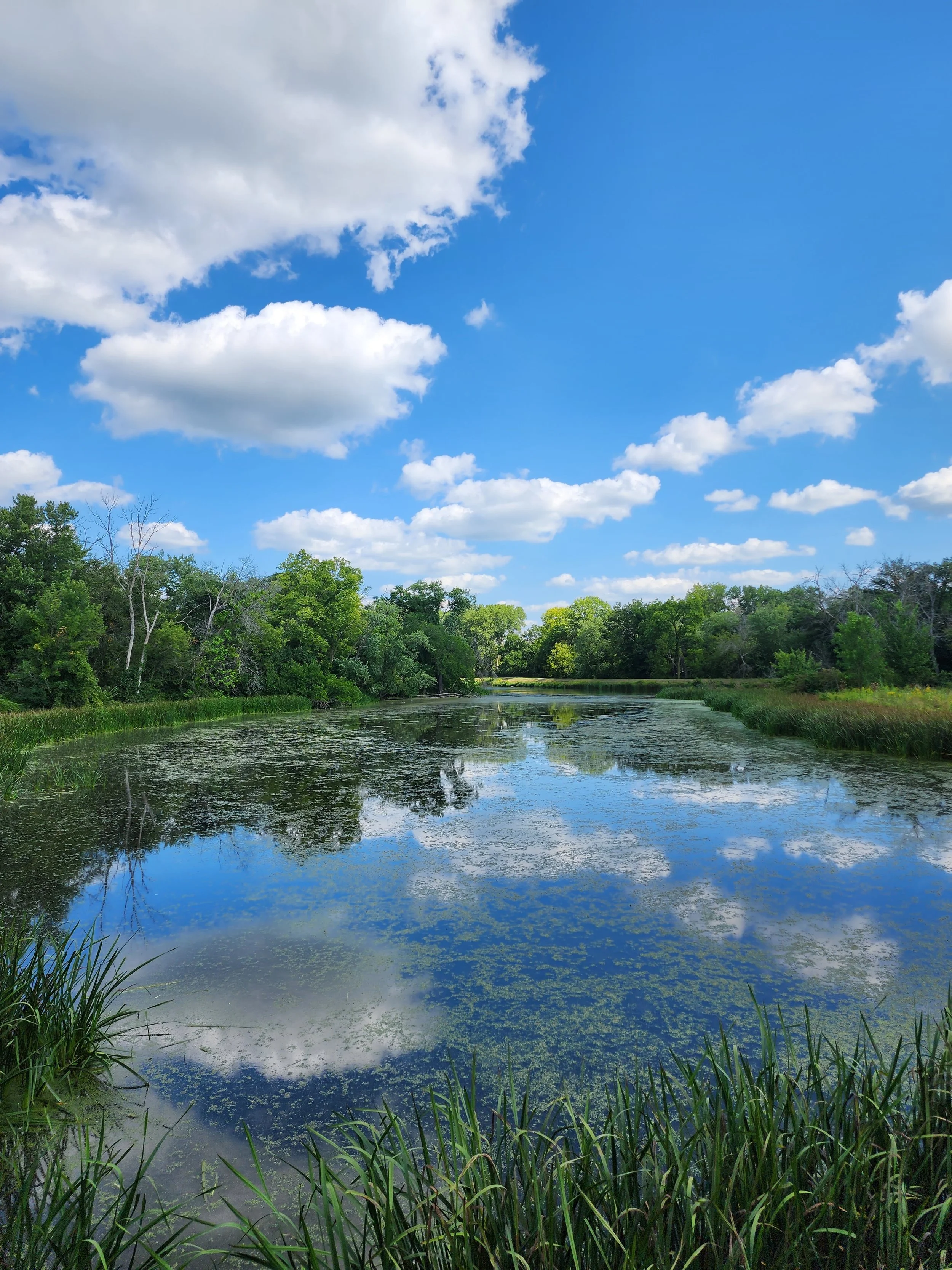
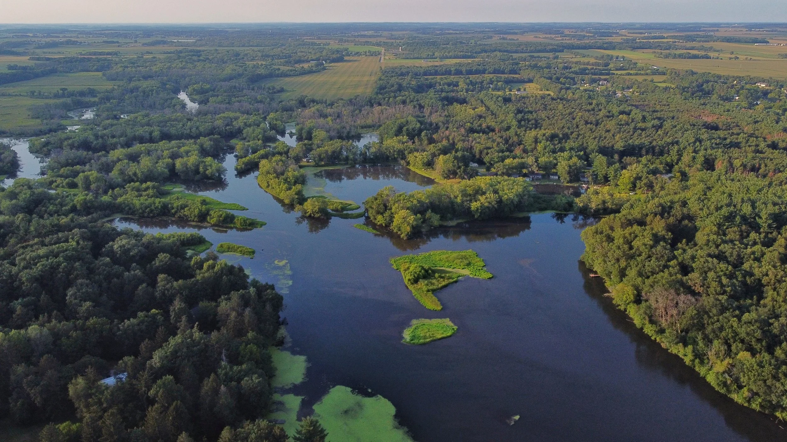
The Sugar River runs roughly midway through this subwatershed as it flows from Albany to the north down through and past Brodhead at the southern end of the subwatershed's boundary. Within the subwatershed, the Sugar River is dammed at two locations, one in Albany forming Albany Lake (102 acres) and one northwest of Brodhead forming Decatur Lake (109 acres). Locally, Albany Lake is also known as Lake Winnetka. Both of these impounded lakes are shallow and heavily silted due primarily to agriculture runoff.
The extreme eastern portion of the Albany Wildlife Area just west of Albany exists within this subwatershed and extends west into the Middle Sugar River Watershed along the Little Sugar River towards Monticello.
Two State Natural Areas reside within this subwatershed: Ward/Swartz Decatur Woods and Abraham's Woods. Muralt Bluff Prairie is just outside the subwatershed northwest boundary.
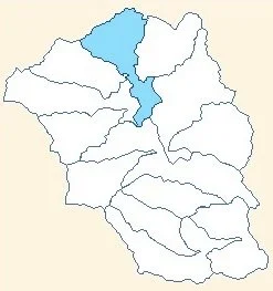
Decatur Lake-Sugar Creek Subwatershed is one of three subwatersheds draining into Decatur Lake, the other two being Searles Creek and Norwegian Creek.
Quick Facts
Hydrologic Unit Code (HUC-12): 070900040605
Area: 23.4 square miles (14,961 acres); 8% of Lower Sugar River Watershed/2011
Counties: Green County/Decatur, Albany, Mt Pleasant, and Spring Grove Townships
Municipalities: City of Brodhead [population 3208 (7/1/2020)], Village of Albany [population 1151 (7/1/2020)]
Primary Land Uses: Agriculture (cropland 47.8%, pasture/hay 19.9% of landcover/2011)
Points of Interest: Sugar River, Village of Albany, Albany Lake (aka Lake Winnetka), City of Brodhead, Decatur Lake, Pearl Island Recreational Corridor (includes Mill Race), Brodhead Historical Society Depot Museum, Sugar River State Trail, Rustic Road No. 27 (Park Road), Albany Wildlife Area, State Natural Areas: Ward/Swartz Decatur Woods, Abraham's Woods and Muralt Bluff Prairie.
Water Quality: Exceptional Resource Water (ERW); Impaired - 303d listed for phosphorus. See section Did You Know? below.
Learn More
The Brodhead dam has been in existence in some form since the mid-1800s (1847-48). It was originally built to establish a millpond (today known as Decatur Lake) to power a sawmill, and by 1849 it was also powering a grist and flour mill. The small settlement of Decatur grew up nearby and by 1857 had grown to some 400 strong; however, its residents and businesses alike soon abandoned their village for Brodhead in order to take advantage of the railroad established there in 1857. Construction of the 3.1 miles long Mill Race from the millpond to Brodhead began in 1858 and was in operation on May 6, 1863. The race furnished power for a flouring mill and later a foundry, several wagon shops, and a plow factory. Electricity was being produced by 1886. This whole area has a rich history to explore and a good place to start is the Brodhead Historical Museum Depot and website. Today, the Mill Race and adjacent land corridor, owned by the City of Brodhead, are now known as the Pearl Island Recreational Corridor. It is being developed to provide year-round recreational opportunities to residents and visitors.
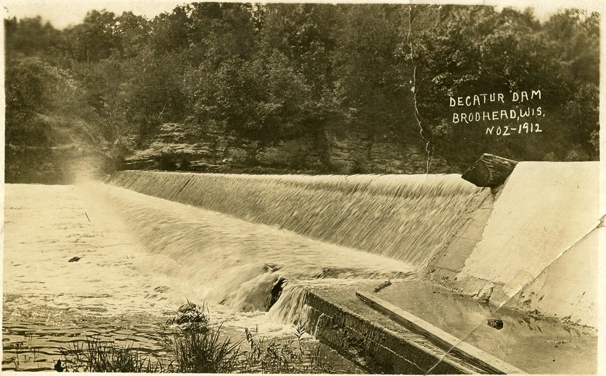
unknown, “The Decatur Dam From 1912,” Brodhead Historical Society, accessed May 6, 2025, https://www.brodheadhistory.org/exhibition/items/show/10395.
A rather fascinating piece of local history involves the de Mun trading post or cabin once situated on the west bank of the Sugar, south of the present-day dam. Constructed in the fall of 1831 by Jules de Mun and abandoned less than a year later in April of 1832, there was no proof the cabin existed until an archeological expedition in 1986 -1987 led by Tom Fey and Donald Thompson found the fire-damaged site. A description of their dig discoveries and a historical review of Jules de Mun was published in the Wisconsin Academy Review, in June 1988, and can be accessed here. Harriet Halloran in July of 1998 published an article based on the journal article in the Brodhead Independent Register which can be viewed here.
Marsh Creek, a small spring-fed stream east of Albany flows southwest and joins the Sugar River below Albany. The Wisconsin Department of Natural Resources (WDNR) has classified this stream as a Class III trout stream.
Recreation in the Sugar River Region
Discover a variety of outdoor adventures in the Sugar River region, where natural features such as the Sugar River, Mill Race, two lakes, the Albany Wildlife Area, Three Waters Reserve, and three State Natural Areas create the perfect setting for recreation.
Three Waters Reserve (TWR) This mission-driven event center and nature reserve offers public trails, private venue rentals, and nature-based educational programs. Proceeds support conservation efforts on the property and throughout the Sugar River watershed.
On the Water Enjoy activities like camping, canoeing, kayaking, tubing, and fishing. Launch your adventure at Headgates Park in Brodhead, which includes a public boat launch and restroom facilities. River rentals are available from Sweet Minihaha and Crazy Horse Campgrounds near Albany and Brodhead, as well as S&B Tubing in Albany.
On the Land Explore the Sugar River State Trail, which begins in Brodhead and is perfect for biking, walking, and birdwatching. Within the Pearl Island Recreational Corridor, find a network of hiking paths along the river in addition to the main trail. Enjoy a picnic at one of the Corridor's new tables or fire pits.
Wildlife & Natural Beauty The wooded Sugar River corridor offers chances to spot white-tailed deer, wild turkeys, bald eagles, woodpeckers, barred owls, red foxes, mink, white pelicans, ducks, turtles, and numerous songbirds.
Seasonal Highlights
Fall: Take a scenic drive along Park Road (Rustic Road #27), surrounded by the golden hues of Black Maples.
Spring: Visit Ward/Swartz Decatur Woods to explore wildflower-filled southern dry-mesic forest. Be mindful of invasive garlic mustard that threatens native plant life.
State Natural Areas Don't miss Muralt Bluff Prairie or Abraham’s Woods. Note: Access to Abraham's Woods requires permission from the UW–Madison Arboretum (608-263-7344).
Whether you're paddling, hiking, or wildlife watching, the Sugar River region invites you to connect with nature and explore the diversity of this vibrant landscape.
Did You Know?
The entire length (81) miles of the Sugar River in Wisconsin is designated as an Exceptional Resource Water (ERW). Yet sections are impaired for excessive phosphorus due to point source discharges by wastewater treatment facilities (e.g. City of Brodhead) and non-point source runoff from agricultural fields and barnyards into tributary streams feeding into the river. The section of the river within the subwatershed, Decatur Lake, and the Mill Race are all impaired for phosphorus and have been placed on the WDNR's 303d impaired waters list.
Why is "Sugar Creek" part of the subwatershed's name and not "Sugar River" as the river figures dominantly in this subwatershed, and nowhere within is there a Sugar Creek? As it turns out Sugar Creek and Sugar River are one and the same. On early maps, the river was referred to as Sugar Creek. Mystery solved!
References:
2011 National Landcover Database: http://www.mrlc.gov/nlcd2011.php
Brodhead Free Press, Vol. 6, No’s. 30 (10/29/14), 31(11/5/2014), 32 (11/12/2014), Looking back at the history of the Brodhead Mill Race by Carol Gombar.